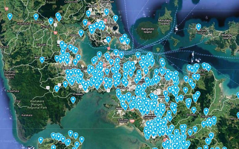
Electronic Map
A recent innovation has been the development of our Electronic Map based filing system. Whilst we always start our studies with the published soil geology from a GNS science geological map we have built our own “soils library” from the many soils tests we have carried out in the Auckland and Waikato regions. The screen shot below shows the locations where we have soils test data from previous site visits which helps build our knowledge in the desk top study undertaken before visiting a site.
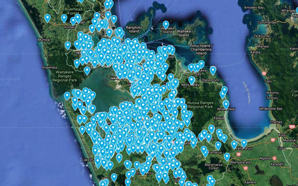
We can zoom into the map and clicking on a marker takes us to the data for that site.
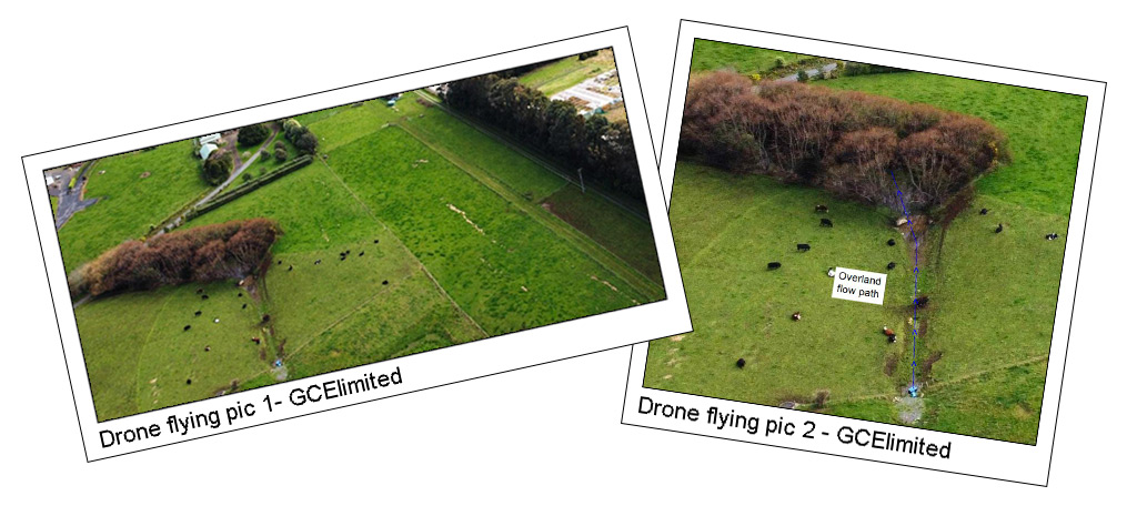
Drone Usage
Whilst Google Earth satellite images are very useful, when it comes to looking at the detail of site features the resolution is not usually as good as we would like. We have invested in a specialist Drone to allow us to take photos to more closely examine land features – such as Overland Flow Paths. Below is a general area drone photograph followed by a closer image of an OLFP. When flying on site even closer examination is possible.

"Our clients are our number one priority, and our services prove just how committed we are to their success". Book an introductory meeting today to learn more about how we can help with your project.